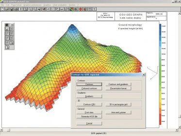
Management and presentation of isographs from any kind of measurements that are available in a point grid at so called measuring points. An obvious area of application is, for example, the graphical presentation of groundwater depth in a set of sounding wells. The measurements and coordinates can be used in position orientated plans
Comments